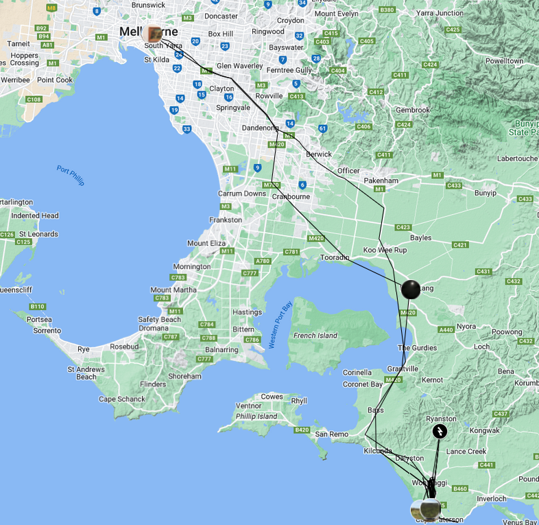
Tagged as data, leased as real estate
The digital landscape has quickly become a contested and highly lucrative space on which tech corporations jostle for our personal data. Trumpeting convenience and community incessant pop-ups encourage us to hand over our location data with the press of a button.
But what do our digital footfalls look like? How accurate are they? What do we give up by handing over our location information so willingly?
This interactive digital map 'Tagged as data, leased as real estate' combines the location history and image data captured by Google from my personal mobile telephone over a four day period from 7-11 June 2017. Those data points are plotted onto the Google Maps interface. A series of critical excepts have been added to the data points with the aim of interrogating what we give up when we use everyday technology.
References
- Cresswell, T. (2015). Place: An Introduction. Chichester, West Sussex: John Wiley & Sons.
- Flanagin, A. J., & Metzger, M. J. (2008). The Credibility of Volunteered Geographic Information. GeoJournal, 72(3), 137-148.
- Gambs, S., M., K., & Prado-Cortez, M. (2011). Show Me How You Move and I Will Tell You Who You Are. Transactions on Data Privacy, 2011(4), 103–126.
- Gibson, R. (2015). Changescapes: Complexity Mutability Aesthetics. Crawley, W.A.: UWA Publishing.
- Goodchild, M. F. (2007). Citizens As Sensors: The World of Volunteered Geography. Paper presented at the Workshop on Volunteered Geographic Information, University of California, Santa Barbara.
- Humphreys, L. (2011). Who's Watching Whom? A Study of Interactive Technology and Surveillance. Journal of Communication, 61(4), 575–595.
- Kurgan, L. (2013). Close Up at a Distance: Mapping, Technology, and Politics. Cambridge, USA: MIT Press.
- Lyon, D. (2001). Surveillance Society: Monitoring Everyday Life. London: Open University Press.
- Marshall, A. (2017). Google Maps Supercharges Location Sharing, Begins Drooling Over Your Data. Wired.
- Miller, C. C. (2006). A Beast in the Field: The Google Maps Mashup as GIS/2. Cartographica: The International Journal for Geographic Information and Geovisualization, 41(3), 187-199.
- Ozolins, N. (2017). Life and death on Google Maps. Overland (5 June 2017).
